Skip to content
  • Home
  • About
  • El mapa
  • ¿Todo en bicicleta?
  • Colombia
  • Ecuador
  • Perú
  • Bolivia
  • Chile
  • Home
  • About
  • El mapa
  • ¿Todo en bicicleta?
  • Colombia
  • Ecuador
  • Perú
  • Bolivia
  • Chile
Diarios de BicicletaA bike ride through the Andes
  • Home
  • About
  • El mapa
  • ¿Todo en bicicleta?
  • Colombia
  • Ecuador
  • Perú
  • Bolivia
  • Chile
Written by admin on August 25, 2019

Las ligas mayores, cápitulo dos
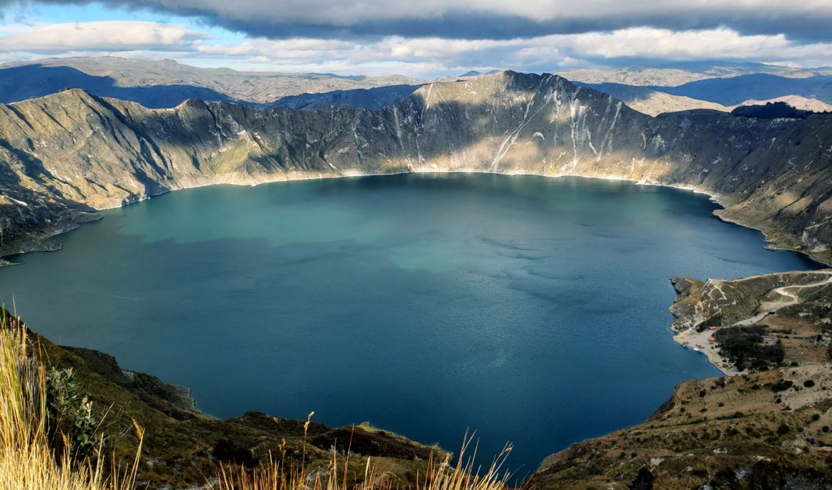
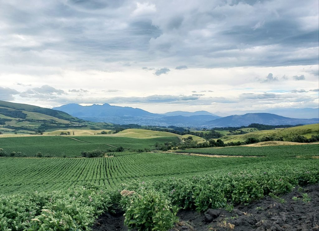
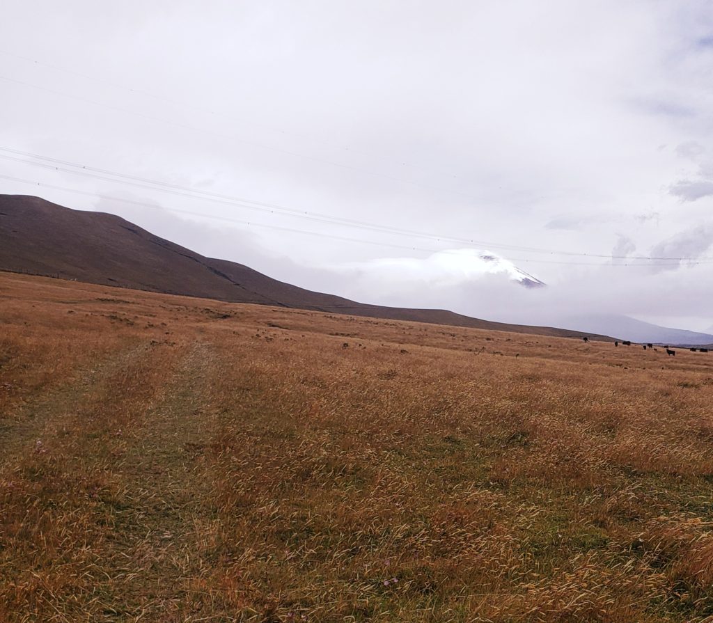
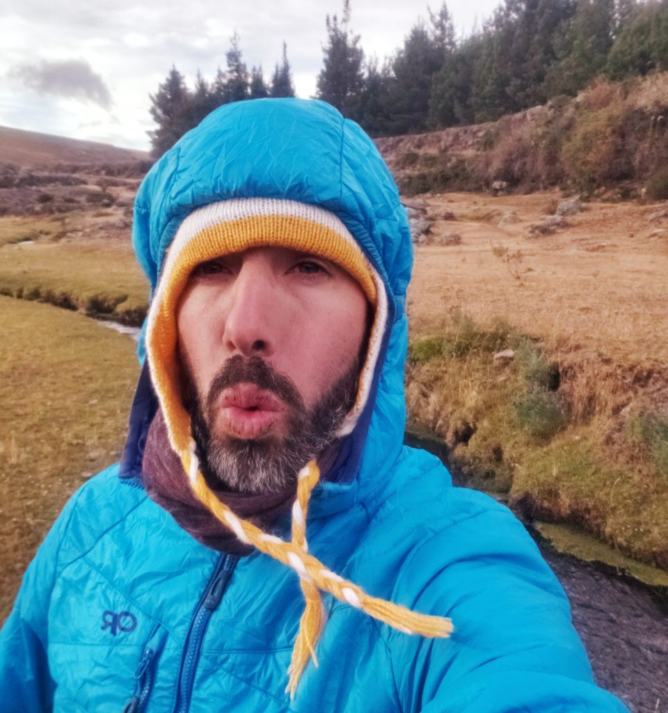
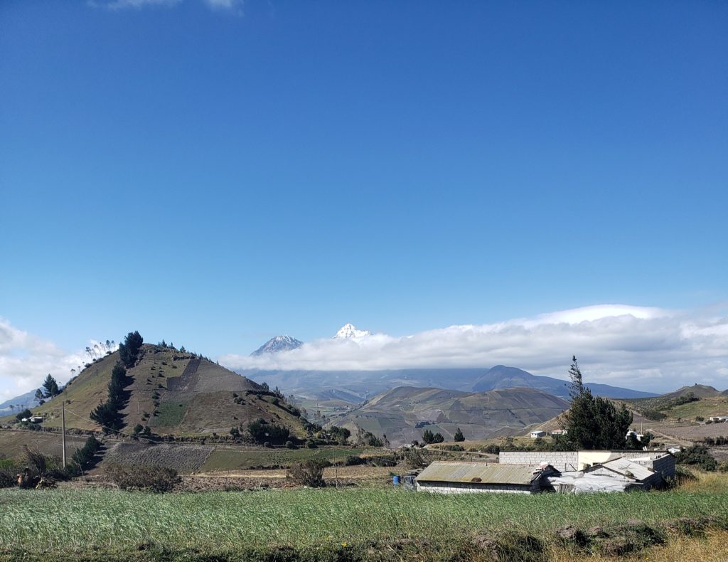
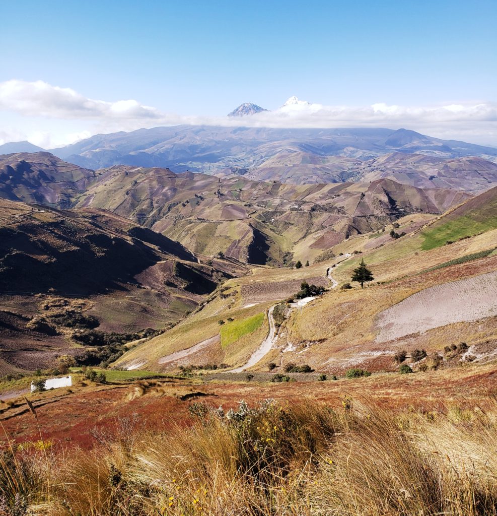
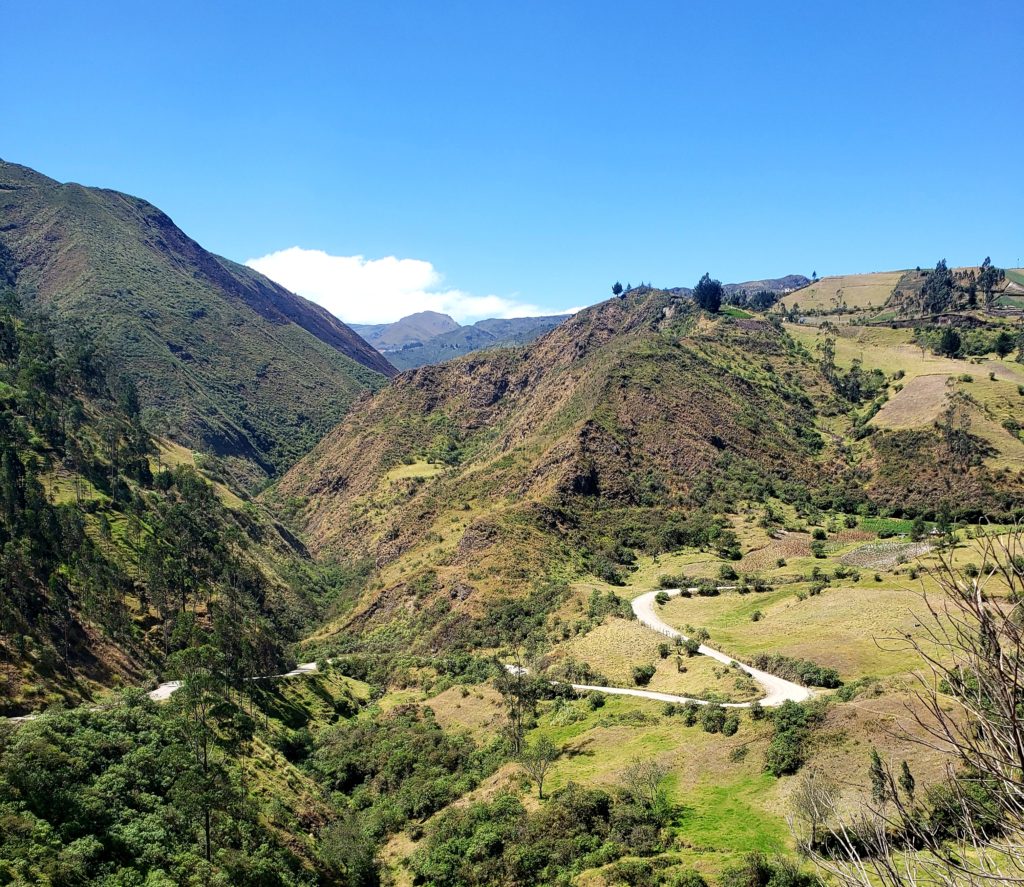
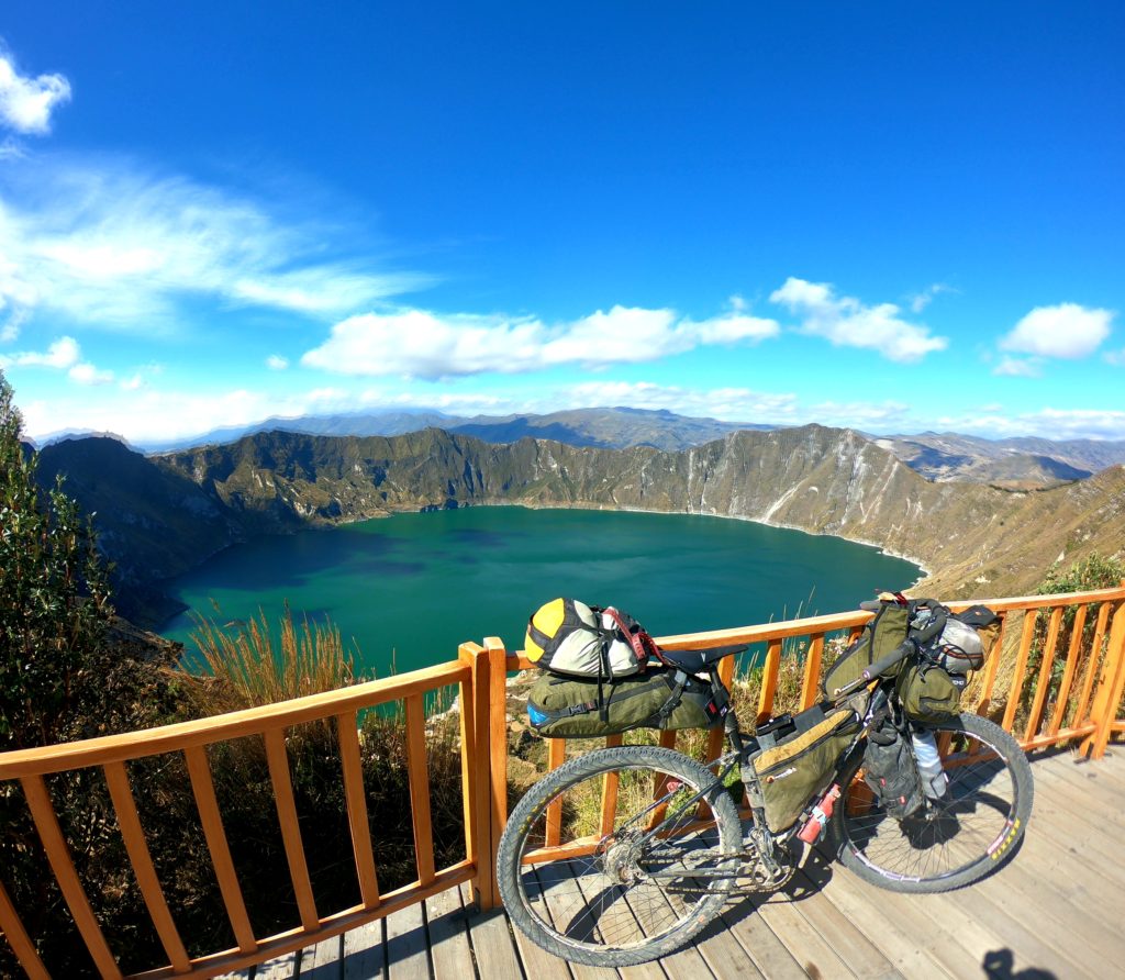
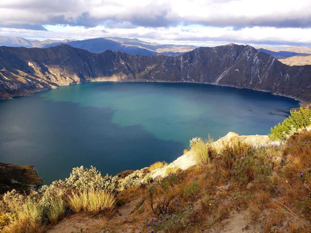
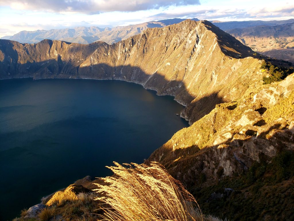
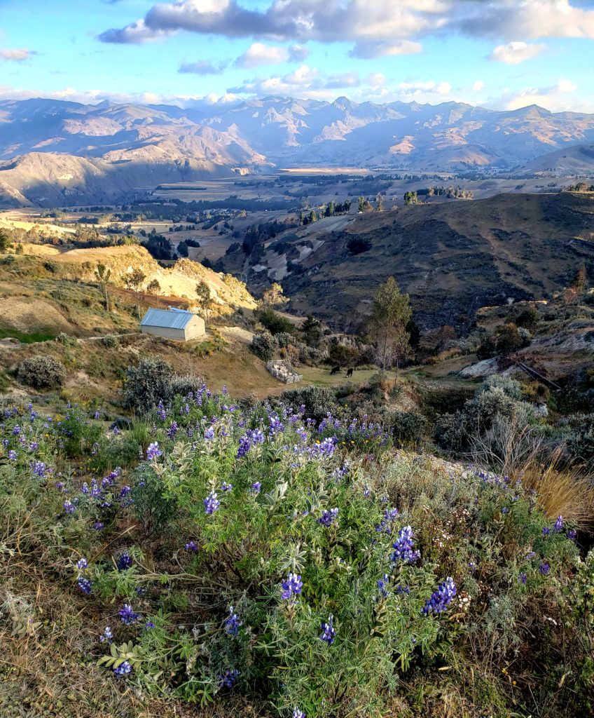
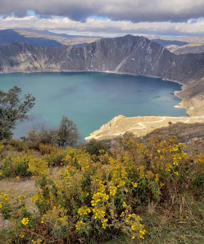
Ecuador

With a new chain installed, dry bags protecting everything inside my bike bags, warmer clothes, a lighter, a backup lighter, and many hours of sleep, I felt I might be ready for another shot at the big leagues. From Quito, I aimed to reach the iconic triangular volcano of Cotopaxi, a notoriously shy mountain that spends most of its days hidden in clouds. I planned to camp somewhere near the volcano – not sure where, but hopefully, I would be prepared this time.

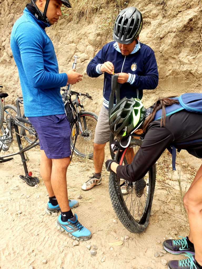
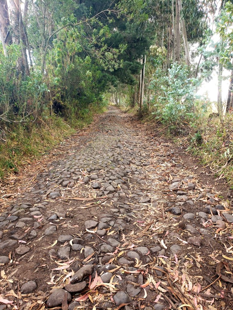
A few miles outside of town, I ran into a few cyclists stopped on the side of the cobblestone road, trying to fix a flat tire. “¿Necesitan algo?” I asked.

“¿Tiene una bomba?” I pulled out my pump and he tried inflating the tire but the air hissed out of a puncture.

“Hay un pincho,” I told them, “no tiene otro neumático?” The two other riders both had extra tubes, but they were 26” in diameter. The guy with a flat needed a 29” tube. I told him I had one if he needed it, but that we should try to patch the punctures first since I was headed places that replacement 29″ tubes aren’t available for sale. We found two punctures in a fang toothed pattern indicating that the tube had been pinched between the tire and the rim on both sides, called a “pinch flat.”

“No tenía suficiente presión en la llanta,” I told him. Riding on the cobblestones, tire pressure makes all the difference. With tubeless tires, I’m able to use a low tire pressure, effectively giving me a bit of suspension to absorb the bumpy impact. But using a low pressure with tubes, he was asking for a pinch flat. Another pair of patches on the same tube indicated a similar pattern of mistake. “Deberías comprar llantas tubeless para las rutas empedradas,” I advised him.

“Si, pero tubeless es muy caro,” he complained.

“Tan caro que muchos neumáticos nuevos?” My eternal justification for expensive gear – that the cost of replacing cheap gear eventually catches up to the cost of the good stuff. He shrugged. He was considering it, I think. He thanked me and they sped off.

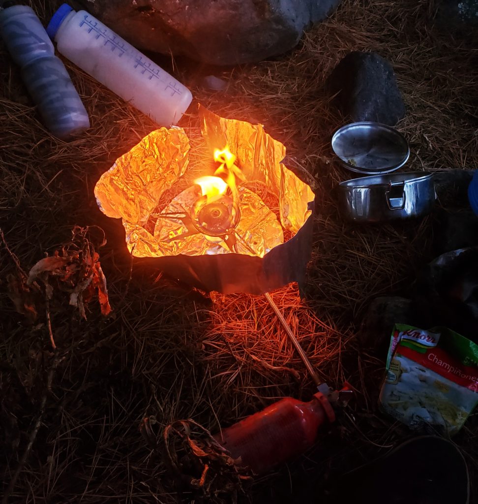
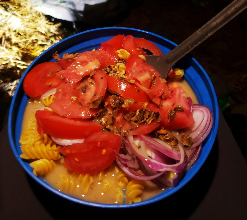
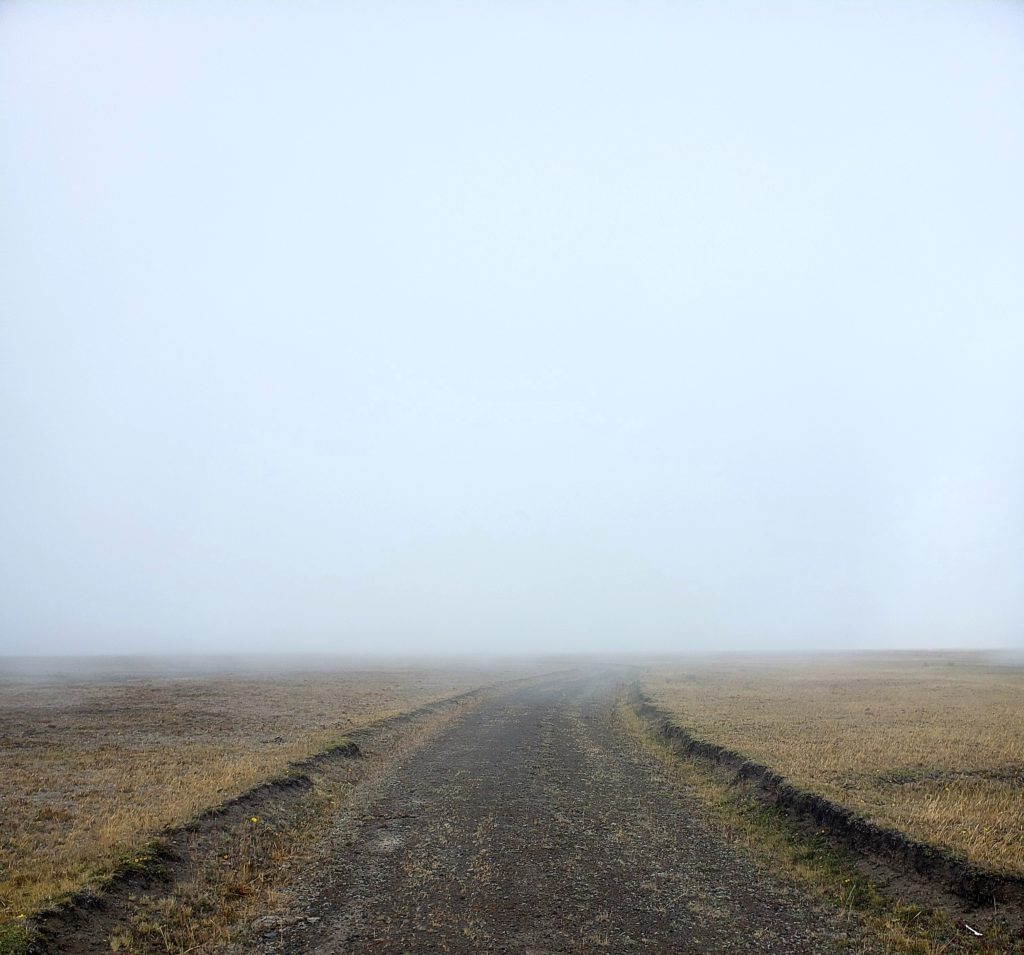
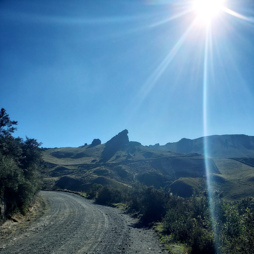
I never saw Cotopaxi that day before finding a camp somewhere below it, in the national park. The wind howled as I finished setting up camp in the dark. As I started cooking, some voices startled me. I had been following a remote trail through the park for hours and hadn’t seen anyone. Two headlamps came into my clearing. 

“Estamos perdidos,” they told me. They wore helmets and backpacks and looked completely flustered and distraught. They explained that they had been climbing a mountain nearby. Caught in fog, wind, and rain, they had lost the rest of their group and were now looking for the rendez-vous at the entrance to the national park. 

“Tengo un mapa en mi celular,” I told them as I took out my phone. I didn’t know where we were in relation to where they came from or where they wanted to go, but at least I was prepared with several different offline topo maps. The man, Pedro, studied them and took some photos.

“¡Que día terrible!” Diana, the woman, exclaimed while she tried to dry her jacket in the inconsequential warmth of my cooking stove.

“¿No tienes miedo acampando aquí?” Pedro asked. I was surprised that he should ask if I was scared, when he was the one wandering lost in the dark. 

“No. ¿Debería?”

“No,” he said, rationality filtering back into his flushed face. Nothing around for miles and miles – what would I be afraid of?

Pedro finished with the maps and urged Diana to get up. “Solo treinta minutos mas,” he told her.

“Si no lo encuentran – vuelve, tengo comida,” I invited them as they wandered into the darkness. They didn’t come back, so I assumed they must have found their group.

As I finished cooking, feasted, and settled into my dry, warm sleeping bag, I thought back to Laguna Mojanda. Sure, that had been an uncomfortable night, cold and hungry, but I had survived. The cyclist earlier today wasn’t properly prepared with a spare tube, but he survived. The mountaineers this evening weren’t properly prepared with maps, but they would survive – I hoped. 

Was I ready for the big leagues? Maybe, maybe not. If not, I’ll survive. And be better prepared the next time. 

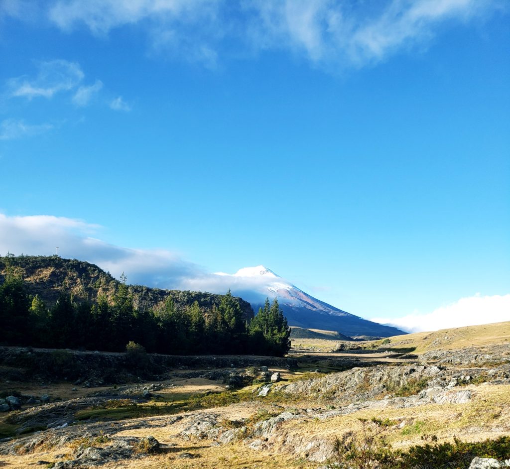
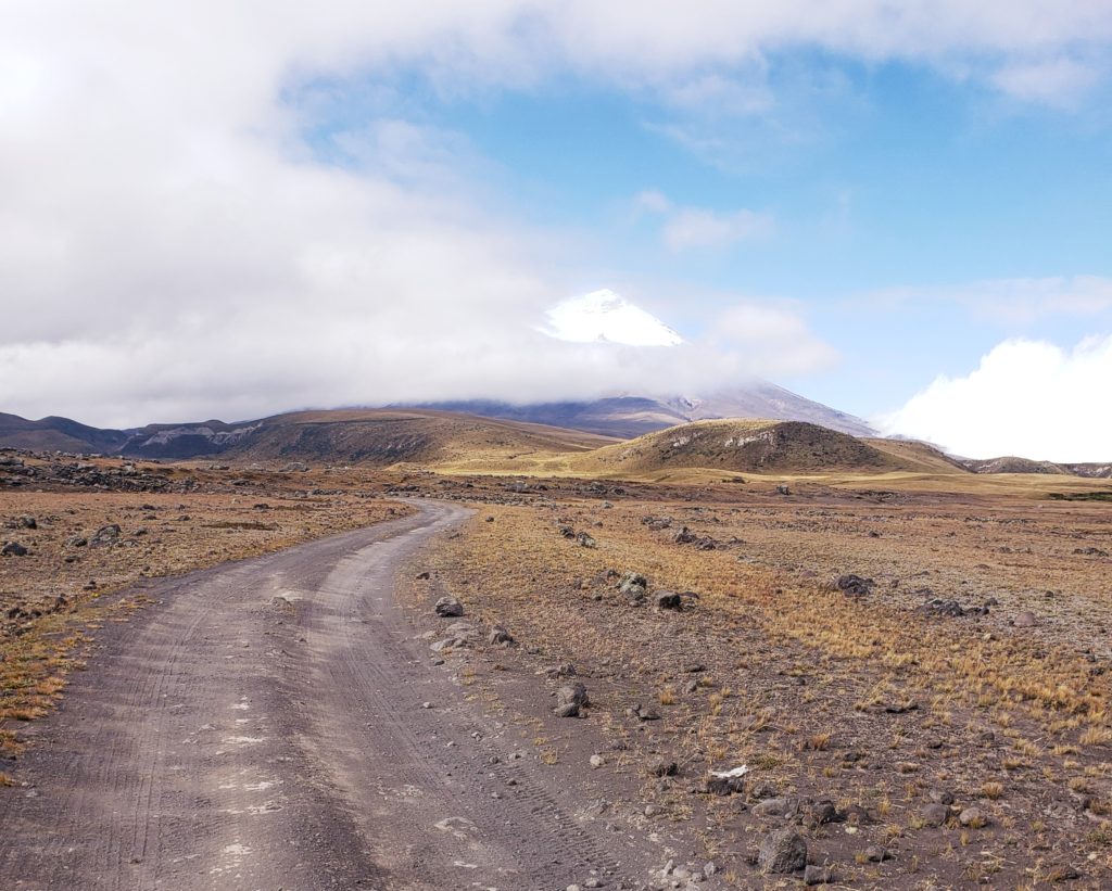
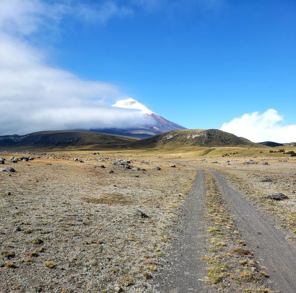
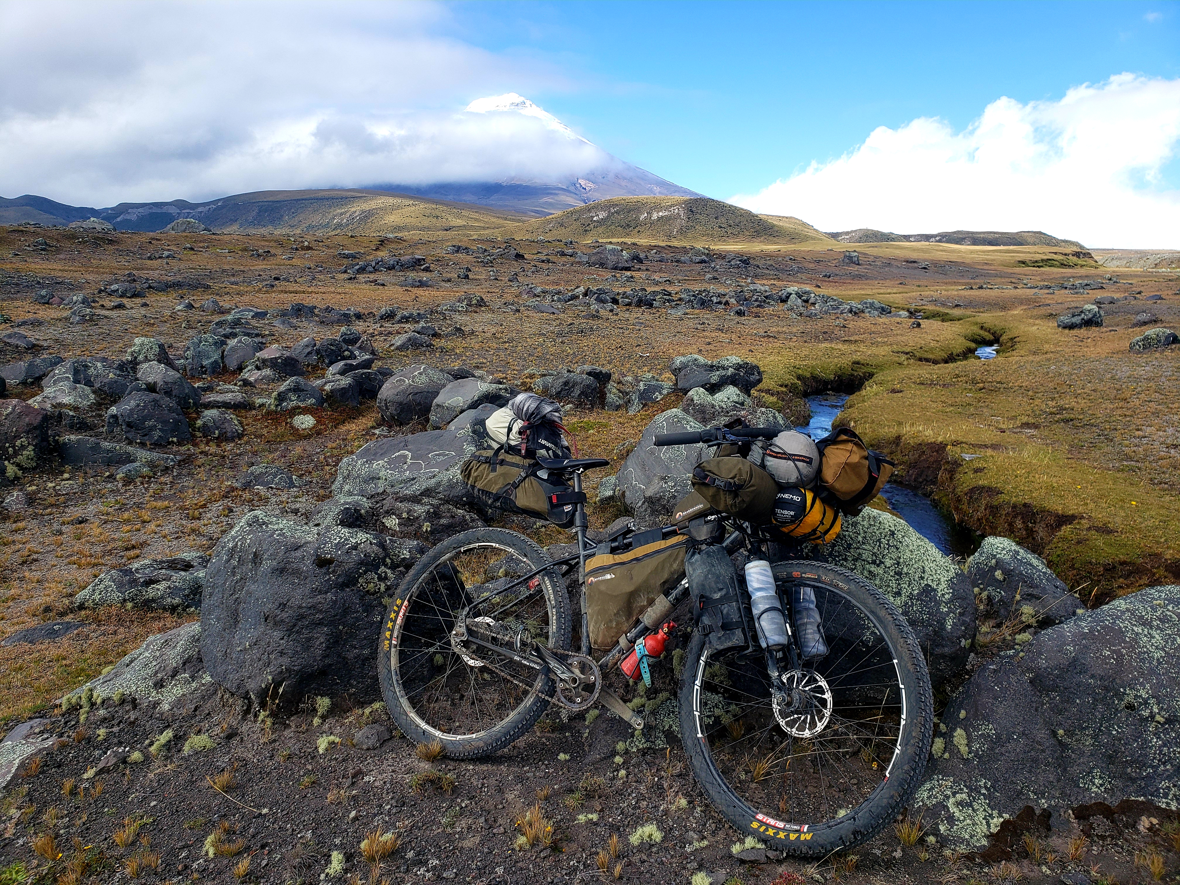
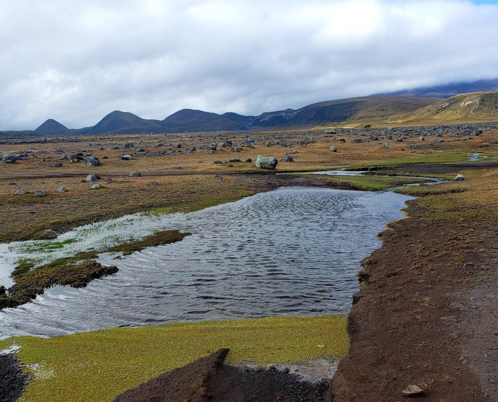
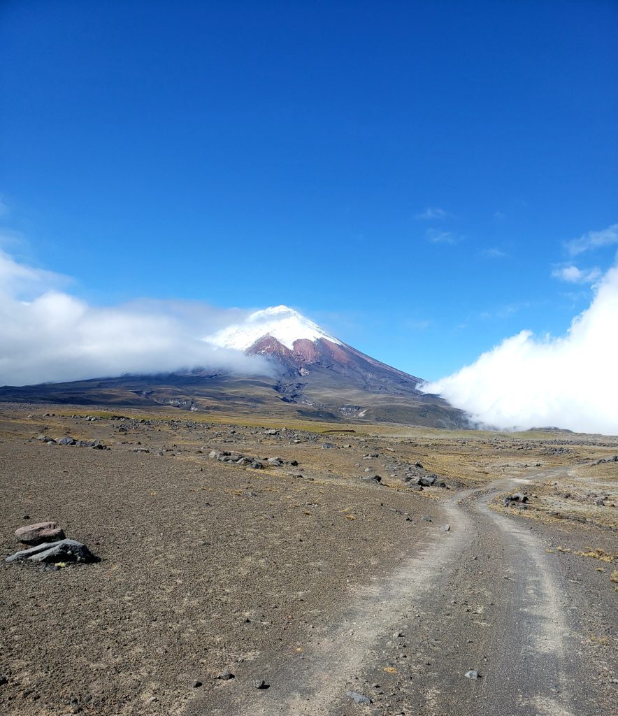
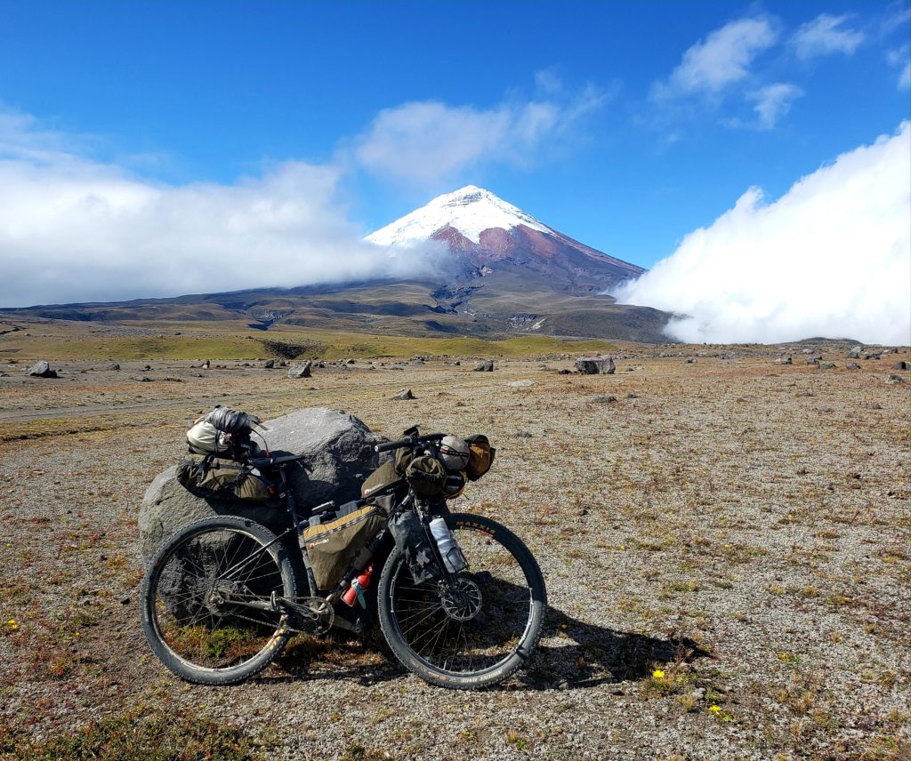
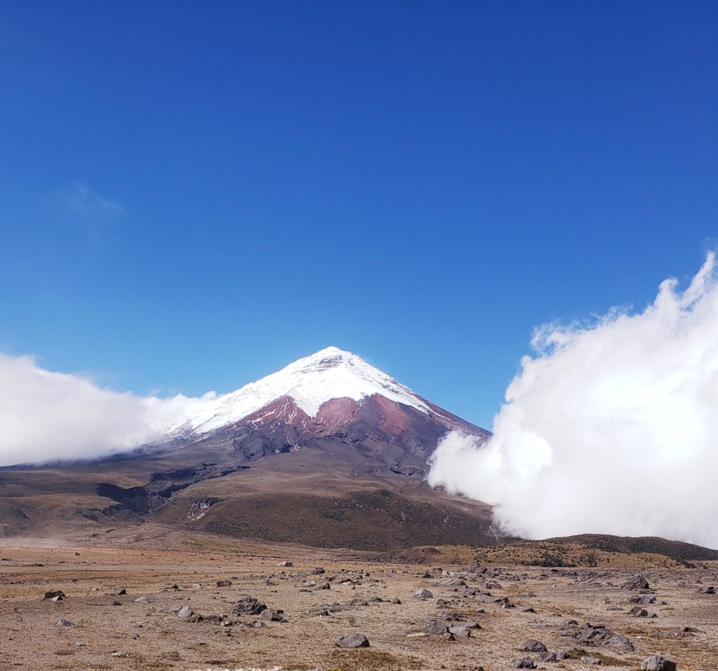
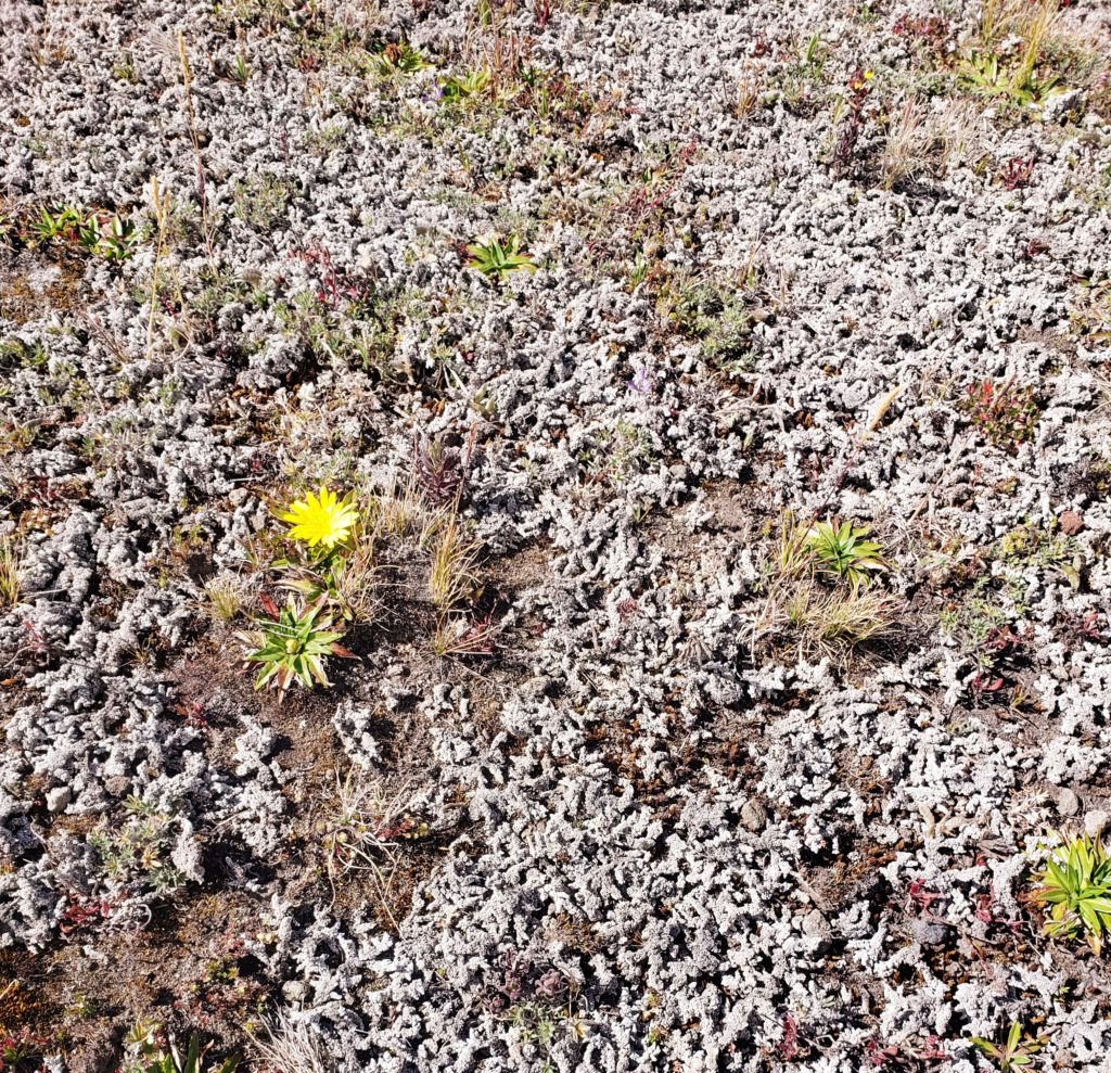
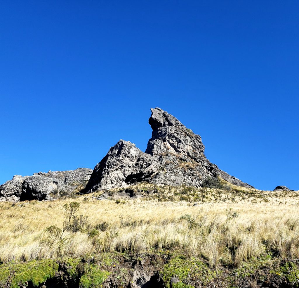
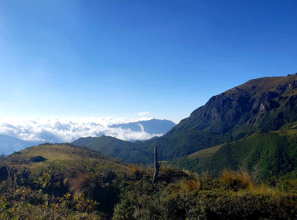
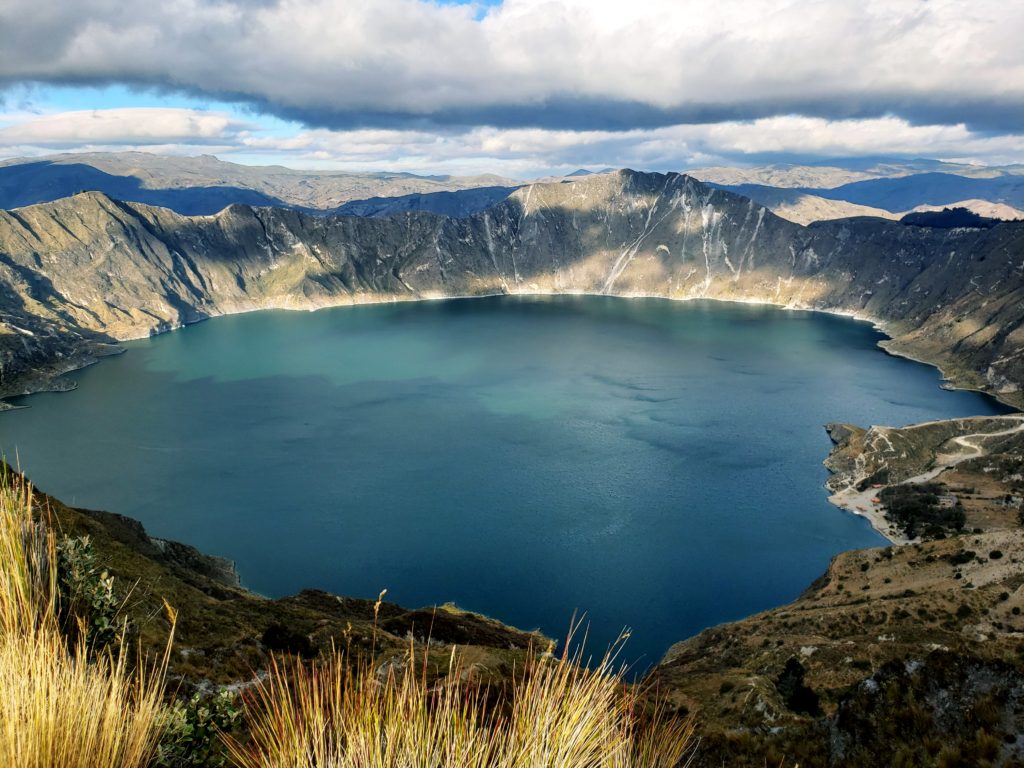
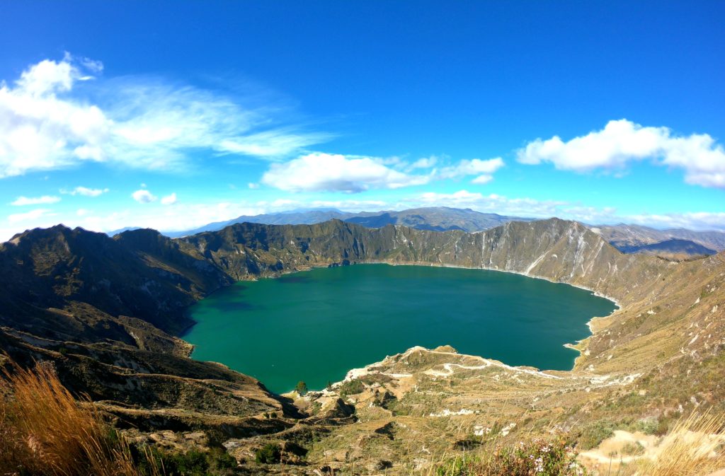
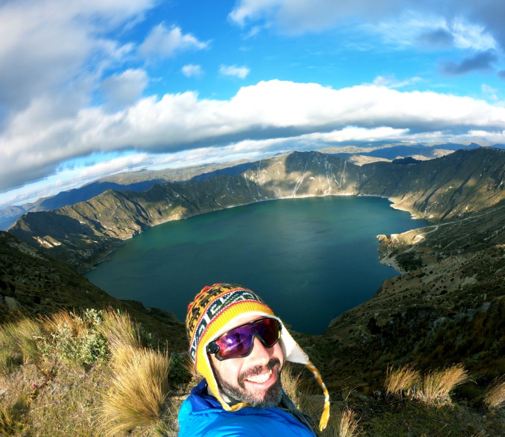
When I awoke in the morning, the clouds had cleared and Cotopaxi loomed over the barren, volcanic moonscape in its full glory. I crawled my way up to the 13,000 foot pass at the mountain’s foot over faint jeep trails, alone with the sun and the breeze and a pale green mat of lichen. Feels good to be in the big leagues, I thought. Ready or not.

Tubes are the worst
In the tiny village of Pintag, I found an Ecuadorian delicacy – hornados (roasted pig) and llanpingachos (a sort of corn pancake)
Not sure if this is a delicacy, but I also found this. It was like merengue.
The cobbles quickly got gnarly as I left Pintag into nothingness
I found myself fighting through a traffic jam of cows. When I got through, the farmers herding the cows told me that there were fallen trees ahead and it would be better if I took a different route.
This route was basically the dirt track between plots of crops on their land
Which turned into a slightly flattened grass path, as Cotopaxi peeked out of a storm ahead.
No beautiful campsite views tonight. I picked the most possibly sheltered spot from the wind
Still a bit chilly
Not going hungry tonight!
There she is!
And then I went into the cloud on the right hand side of the last pic, and the fun was over
This funny lichen covered the ground throughout cotopaxi
A little later, I got a glimpse of the Ilinizas coated in snow
This guy greeted me to Isinlivi, a funny little town. It was all of two blocks long, but it was a stop on a well known trekking route called the Quilotoa loop.
As such, it had a posh hostel, “Lllullu Llama,” that offered a jacuzzi, family style meals, and yoga classes. For a town this remote- all this was a little shocking. I had not expected much here.
I made friends with solo travelers from France, Netherlands, Thailand, and Turkey. There were also a few American and Spaniard families who I didn’t speak as much with.
The next day took the trekking path to the famous Quilotoa crater. I had been unsure about the route – some of the roads didn’t show up on Google Maps, the elevation gain looked absurd, and there was a Strava segment entitled “Sand Cliff Death March.” However, the folks at Llullu Llama said that it was fine, that was the route they used for bike tours (albeit, in reverse, a net downhill, without baggage).
The landscape was covered with fields of these beautiful purple flowers. Pretty soon I realized they were cultivated, not wild. They had a pod with beans growing on them.
I asked a woman what they were. “Chochos,” she called them. The bean had to be soaked for several days before it was ready to eat, but then it was served in soups and ceviches, she told me. A few days later, I would find a ceviche de chocho at a stand on the street. They were as tasty as their flowers were pretty!
This was the majority of the traffic I saw en route to Quilotoa
I tried to have a conversation with this woman but the Quichua influence on her Español was too strong. I recongnized the words “sacar” (to take out) and “pagar” (to pay) and “avena” (oats) – I think she was telling me that they paid her for cutting the oats?
Quilotoa! There is a town at the top of the crater that has just cropped up in recent years due to the popularity of the trek. Lots of construction and, a very cold little town with no hot water. At my hostal, the water wasn’t working at all and the wifi was out because the wind had blown the dish off the roof. On the plus side, most of the establishments were run by indigenous families. I was surprised to hear my host talking on the phone to his friends in Quichua, which is inundated with the “sh” sound that is extremely rare in Español.
You can hike around the rim of the whole crater, about 6 miles, I think. Unfortunately, I didn’t have the energy. Would make an amazing trail run!
You can also hike down to the lake, about 1500′ below, and take a boat out during the day, I think.
I walked on the rim trail about a half hour in each direction from the town to get some different views for the sunset.
The view in the other direction from the crater wasn’t bad either. I’d head toward those mountains tomorrow.
The crater rim was covered in flowers.

1 comment

  • mary visconti has written: August 27, 2019 at 1:24 am

    Your pictures are breathtaking!!! Wow!! Can’t wait to show Mr. Joseph!! Glad all is going well!
    Xmary

Archives

  • March 2020
  • February 2020
  • January 2020
  • December 2019
  • November 2019
  • October 2019
  • September 2019
  • August 2019
  • July 2019
  • June 2019

Calendar

May 2025
M T W T F S S
« Mar    
 1234
567891011
12131415161718
19202122232425
262728293031  

Categories

  • Bolivia
  • Chile
  • Colombia
  • Ecuador
  • Perú
  • Uncategorized

RSS ¿Dondé he estado montando?

Copyright Diarios de Bicicleta 2025 | Theme by ThemeinProgress | Proudly powered by WordPress